About
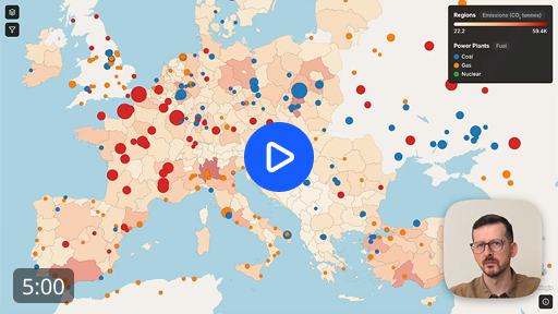
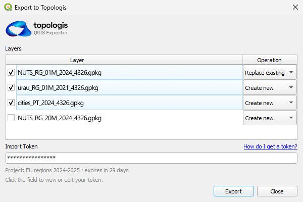
Topologis is a web-based GIS for publishing interactive maps. It handles the last part of GIS work: import, style, configure, share. The analysis itself happens in QGIS or ArcGIS Pro. Topologis is what gets the finished map in front of the person who needs to see it.
I kept running into GIS folks complaining about the same thing in different ways. Sharing finished work was harder than it should be. You either handed a client a static PDF and lost every interactive thing about the map, or you walked them through signing up for a platform they didn't want to use. The work was done. Getting it to the audience was broken.
Topologis is what I'd build for that specific problem.

Nikolay Dyankov

Why Topologis exists
Most GIS work ends in a deliverable for someone who isn't a GIS analyst: a client, a planning committee, a board, a stakeholder, the public. Getting the map to that person is supposed to be the easy part. In practice it's where things fall apart.
There are two common options today. Send a screenshot and strip out everything that made the map worth making. Or put a non-technical audience through an Enterprise GIS platform that wasn't designed for them. Topologis is built for that gap and nothing else.
Company
Topologis is operated by Topologis VCC, registered in Bulgaria since 2026.
Registration number: 208806586
Email: contact@topologis.com