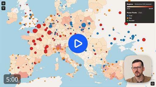
See Topologis in 5 minutes
A full walkthrough: import a CSV and a GeoPackage, join them on a shared key, style them by field, add filters and tooltips, and publish an interactive map anyone can open without an account.
Chapters
Explore the result
Try the layer controls, adjust the filters, inspect a few power plants, or open the map in the share page.
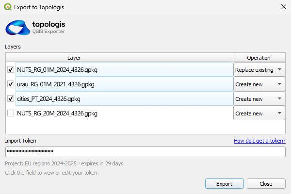
Want to rebuild it yourself? Download the sample datasets and follow along.
Open share page Download the datasets Start free 14-day trial
No credit card required. Try the complete toolkit, no limitations.